
Create Hexagon Tessellation
Hexagons can be utilized to partition the landscape into sampling locations, helping to ensure that all regions within the study area are represented by the sampling results. Such sampling schemes are often used by wildlife biologists, aquatic chemists, and other researchers. CRWR has created a tool to generate hexagons in ArcGIS version 10.1.
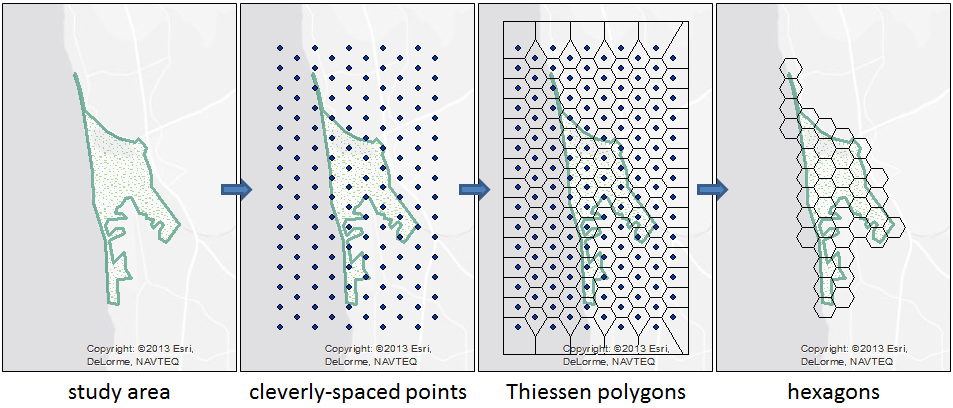
The Create Hexagon Tessellation tool creates a mesh of regular hexagons overlapping a study area. This geoprocessing tool include built-in help that describes how to use the tool. To get started, download and unzip the files from the link below. You can then add the Tessellation toolbox to ArcMap or browse to the toolbox in ArcCatalog. The tool itself is implemented as a geoprocessing model which utilizes a Make Thiessen Inputs tool, also located in the toolbox.
The model tool is fairly simple. The model uses a script tool to create a mesh of points. The points are spaced such that if you run the Create Thiessen Polygons tool included with ArcGIS, regular hexagons (those of equal side length with internal angles of 120 degrees) are generated. The model runs these tools and then intersects the result with the study area to produce the final hexagon mesh.
If you don’t like the result, you can choose a different hexagon size and run the tool again, or you can use ArcMap’s editor to fine tune the hexagon locations. You can also dig into the relatively small bit of script code or change tools within the model to get the result you’re looking for.
Feedback, including interesting case studies and suggested improvements for future versions of the tool, can be directed to Tim Whiteaker (whiteaker@utexas.edu).
Happy Hexagon-ing!
 DOWNLOAD
Last updated 2015-05-22